Drone Photogrammetry
Transform aerial imagery into precise 3D terrain models, orthomosaic maps, and volumetric data. Our FAA Part 107 certified pilots operate enterprise DJI M400 RTK drones delivering survey-grade accuracy for construction, land development, and site documentation. Track construction progress, calculate cut/fill volumes, and create GIS-ready deliverables.
Key Features
Industry-leading capabilities that set our drone photogrammetry services apart.
RTK Positioning
Centimeter-level accuracy with real-time kinematic GPS.
Orthomosaic Maps
True-scale aerial imagery stitched into seamless base maps.
3D Terrain Models
Digital Surface Models (DSM) and Digital Terrain Models (DTM).
Volume Calculations
Accurate cut/fill and stockpile volume measurements.
Progress Monitoring
Regular flyovers to track construction progress over time.
GIS Integration
Deliverables in GeoTIFF, DXF, and standard GIS formats.
See It In Action
Watch our drone photogrammetry technology at work.
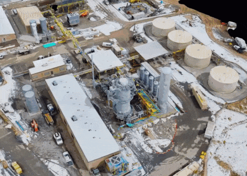
Construction Site Mapping
Aerial photogrammetry for construction progress monitoring
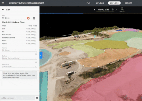
Volume Calculation
Accurate stockpile and cut/fill volume measurements
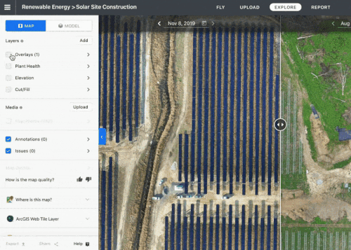
Construction Timeline
Track project progress over time with aerial documentation
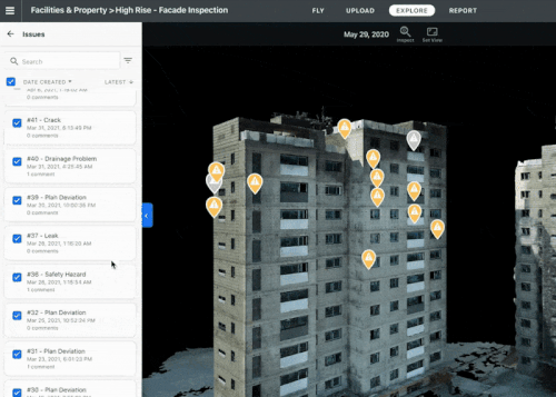
Facade Documentation
High-resolution building facade mapping
Our Process
A streamlined workflow designed to deliver exceptional results.
Flight Planning
Define area, accuracy requirements, and deliverables.
Ground Control
Set survey-grade ground control points if required.
Flight & Capture
FAA-certified pilots execute the flight mission.
Processing
Photogrammetric processing and deliverable generation.
What You'll Receive
- Orthomosaic (GeoTIFF)
- Digital Surface Model
- Digital Terrain Model
- Contour Lines
- 3D Mesh
- Volume Report
Key Benefits
- Survey large areas quickly
- Safer than manual surveying
- Accurate volumetric data
- Track construction progress
- Create base maps for design
- Document site conditions
Industries We Serve
Our drone photogrammetry services support professionals across these industries.
Frequently Asked Questions
What accuracy do you achieve?
With RTK and ground control, we achieve 1-2cm horizontal and 2-3cm vertical accuracy.
How large an area can you map?
We regularly map sites from 1 acre to 1,000+ acres in a single day.
Do you need ground control points?
For survey-grade accuracy, yes. For general mapping, our RTK drones provide sufficient accuracy.
Ready to Get Started?
Request a custom quote for your drone photogrammetry project. We'll respond within 1 hour with pricing and availability.