3D Laser Scanning
Document any space with millimeter-level precision using our Trimble X12 and NavVis VLX3 scanners. Our terrestrial and mobile laser scanning solutions deliver dense point clouds that architects, engineers, and contractors rely on for renovation, retrofit, and facility management projects. With 92% of construction firms seeing ROI in year one from 3D scanning, join industry leaders transforming their workflows.
Key Features
Industry-leading capabilities that set our 3d laser scanning services apart.
±2mm Accuracy
Survey-grade precision that meets the most demanding project requirements.
Full-Color Registration
Photorealistic point clouds with HDR imagery overlaid on scan data.
High-Density Capture
Up to 2 million points per second for comprehensive coverage.
Mobile Scanning
NavVis VLX technology for rapid capture of large facilities.
Multiple Exports
E57, LAS, RCP, PTS, and more—compatible with all major software.
QC Verified
Every project includes quality control verification and accuracy reports.
See It In Action
Watch our 3d laser scanning technology at work.
3D Laser Scanning in Action
Watch how we capture millimeter-accurate point clouds

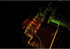
LiDAR Point Cloud Processing
Dense point cloud data visualization
Our Process
A streamlined workflow designed to deliver exceptional results.
Site Assessment
We evaluate access, control points, and equipment needs.
Field Capture
Our licensed technicians capture all required areas.
Registration
Point clouds are aligned and quality-checked.
Delivery
Receive cleaned, registered data in your preferred format.
What You'll Receive
- Registered Point Cloud (E57)
- ReCap Project File
- Navisworks Compatible
- PDF Report
- Raw Scan Data
- Accuracy Verification
Key Benefits
- Eliminate costly field revisits
- Accurate as-built documentation
- Clash detection before construction
- Historical record for future projects
- Insurance and legal documentation
- BIM-ready deliverables
Industries We Serve
Our 3d laser scanning services support professionals across these industries.
Frequently Asked Questions
What accuracy do you achieve?
Our Trimble and Leica scanners achieve ±2-4mm at typical working distances. We can achieve sub-millimeter with total station control.
How large an area can you scan?
We regularly scan facilities over 1 million sqft. Our mobile scanners can capture 300,000+ sqft per day.
Do you scan occupied spaces?
Yes, laser scanning is non-intrusive. We can work around occupied spaces with minimal disruption.
Ready to Get Started?
Request a custom quote for your 3d laser scanning project. We'll respond within 1 hour with pricing and availability.